This section describes the various map layers available in Visivi. You can access the layers from the Map Layers tool on the right hand side of the application.
|
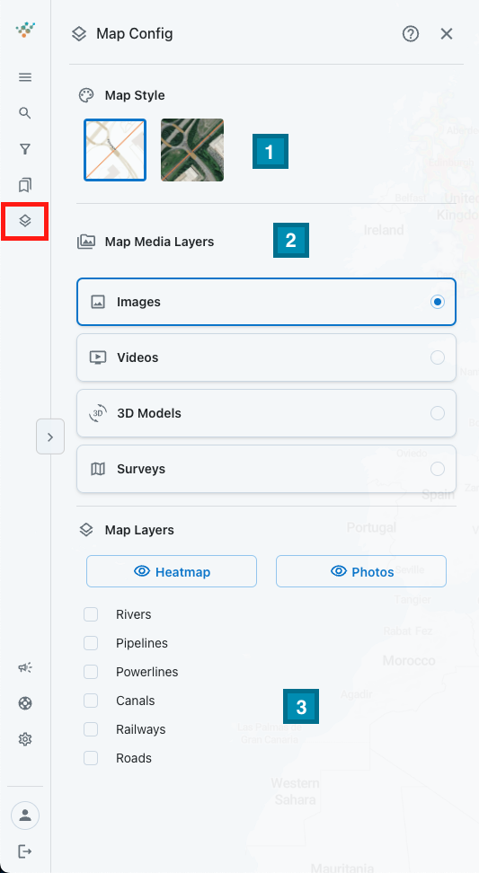
1️⃣ |
The Map Layer allows you to switch between different Map Styles. The Map view shows a Street Mapping view with roads, buildings, rivers etc clearly visible and labelled. Useful for general orientation and reporting where such a simplified backdrop makes for clearer map displays, whilst the Satellite view shows a global image mosaic of high resolution satellite imagery. Great when zooming into detail and looking at features as you may see them on the ground. Not as up-to-date at the oblique imagery stored in Visivi, but a good basis for searching for detailed location. |
|
2️⃣ |
Map Media Layers enables you to switch between data types. For example, between images and videos which will represented on the map as orange photo dots or blue video lines. |
|
3️⃣ |
The Select Layers button allows you to switch the Heatmap and/or Photos layers off by clicking the Heatmap or Photos button, allowing you to view the asset or network without the layer of images. Depending on what you are working on, there will be a number of Overlays that are specific to your project. For instance, if it is a rail project, there would be a tracks layer, a stations layer and maybe a regions layer, whilst a pipeline will have the pipelines route, AGI’s and maybe important crossings. More than one Overlay can be displayed at a time. They also come from a variety of sources, depending on your business. |