Visivi allows you to draw lines and polygons of a particular subject which allows you to measure distances on the mapping and also on geo-referenced oblique images.

Map Measuring Tools
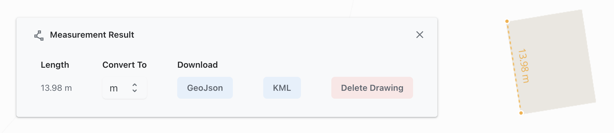
Measure tool: Measurements can be displayed in metres, miles or kilometres and downloaded for use in other applications.
Area tool: Measurements can be displayed in metres, miles or kilometres squared, and downloaded for use in other applications.
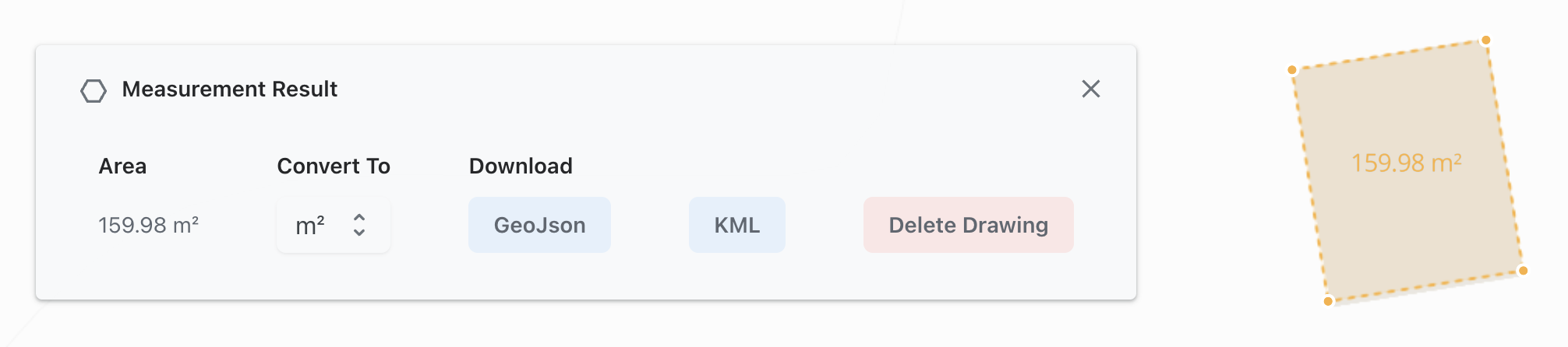
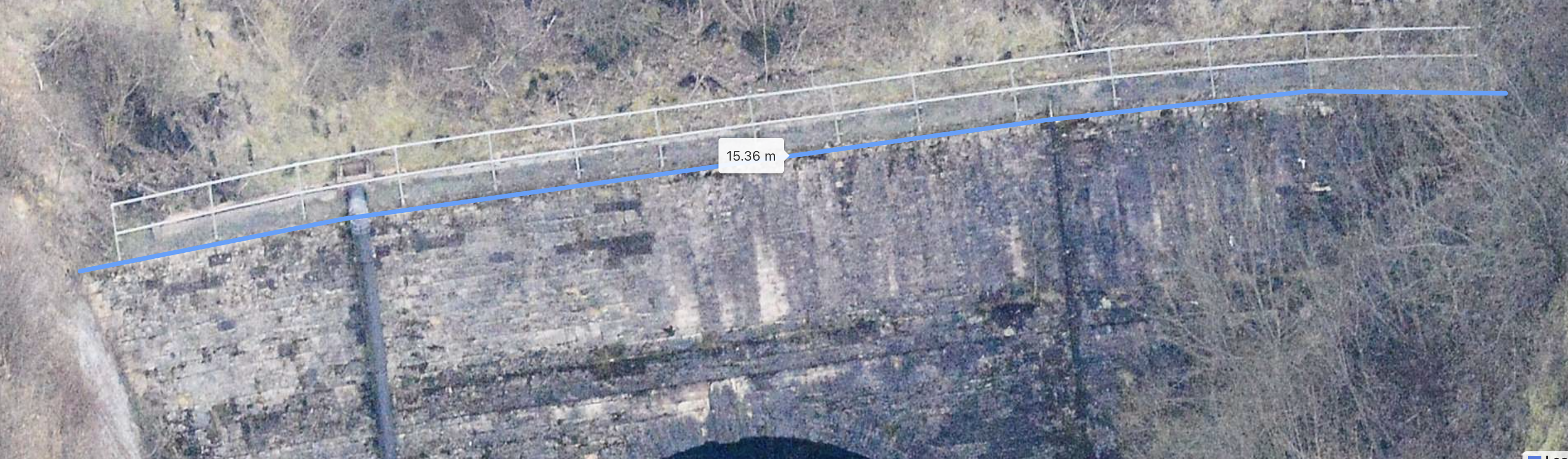
Image Measuring Tools
In addition, measurements can be taken of items of interest within the oblique images: